


Colby and Isaac joined me to hike the 8.8 mile approach trail from Amicalola Falls to Springer Mountain, the southern terminus of the AT. | Mile -8.8 GA 3/4/17
Southern terminus of the Appalchian Trail on Springer Mountain, GA. | Mile 0.0 GA 3/5/17
Isaac, myself, Clover and Colby on the summit of Springer Mountain. | Mile 0.0 GA 3/5/17
Long Creek Falls | Mile 5.2 GA 3/5/17
Ramrock Mountain, photo credit to Chili Mac. | Mile 18.9 GA 3/6/17
Early morning hike to outrun a storm. | Mile 21.9 GA 3/7/17
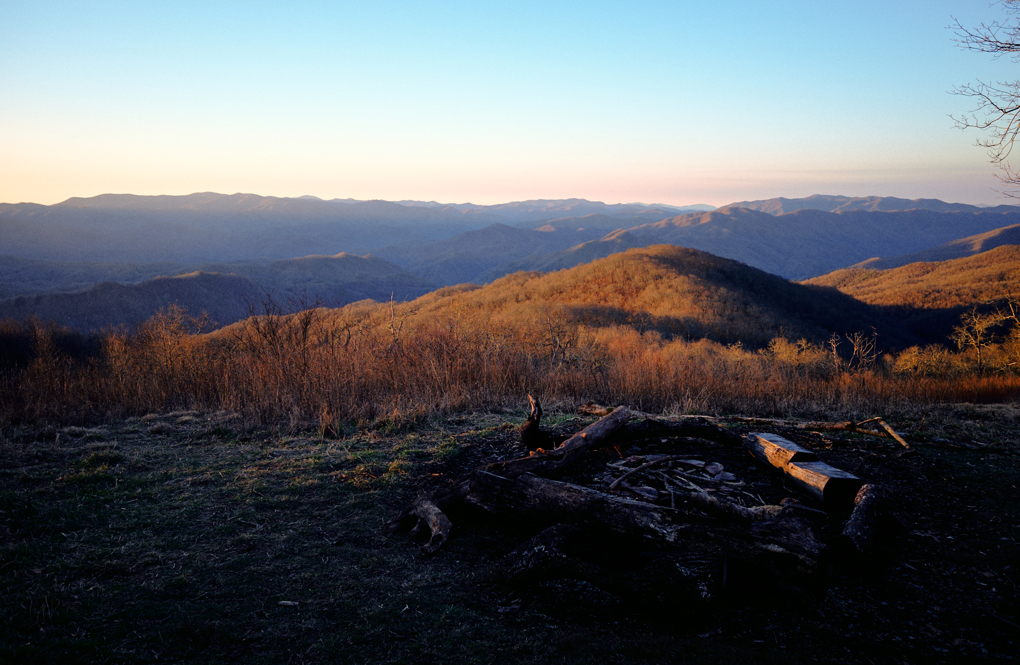
My first truly panoramic view on the summit of Levelland Mountain. | Mile 33.1 GA 3/8/17
One of the first and only fires of the hike atop Blue Mountain. Later that night a massive thunderstorm rolled through, bringing 60 mph winds and turrential rain. | Mile 50.2 GA 3/9/17
Lieutenant Dan warms his feet by the fire. | Mile 50.2 GA 3/9/17
Grapenut and I in a gap called Swag of the Blue Ridge. He and I would continue to hike together for ~1300 miles. Low temperatures and high winds brought us together the night before. | Mile 61.9 GA 3/11/17
We were told snow was coming, so we hopped into Hiawasse, GA for the night. We woke up to some slushy snow, which resulted in us taking a zero. It melted that night and we hit the trail the following morning. | Mile 69.3 GA 3/12/17
Fishstix and Grapenut getting out of the wind while cooking dinner in Grapenut's rainfly at Plumorchard Gap. | Mile 73.8 GA 3/13/17
It snowed again overnight and temperatures dropped drastically, somewhere in the ballpark of 20 degrees. The view was like walking through Narnia, a truly magical energy filled the air. | Mile 75.0 GA 3/14/17
Walking in the cold isn't as fun as walking when itt's warm. | Mile 75.0 GA 3/14/17
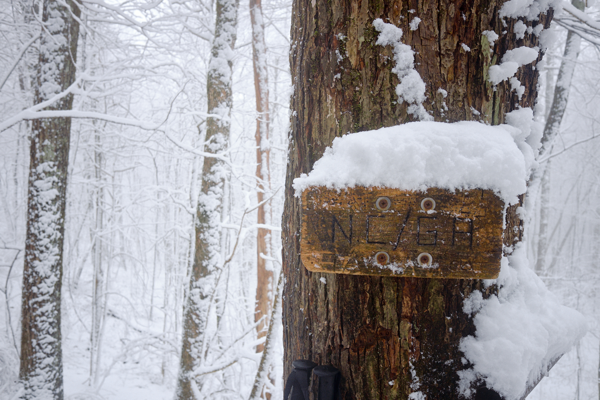
Georgia/North Carolina border. The moment we crossed the border the weather took a turn for the worse. Temperatures were as low as -18 with wind chill in town, so 4,000 feet up was most likely worse. | Mile 78.2 GA/NC 3/14/17
Snow covered rhododendron tunnel. | Mile 79.0 NC 3/14/17
Fishstix, Grapenut and I trudging through pure misery. We convinced ourselves it was all good by smiling. | Mile 80.2 NC 3/14/17
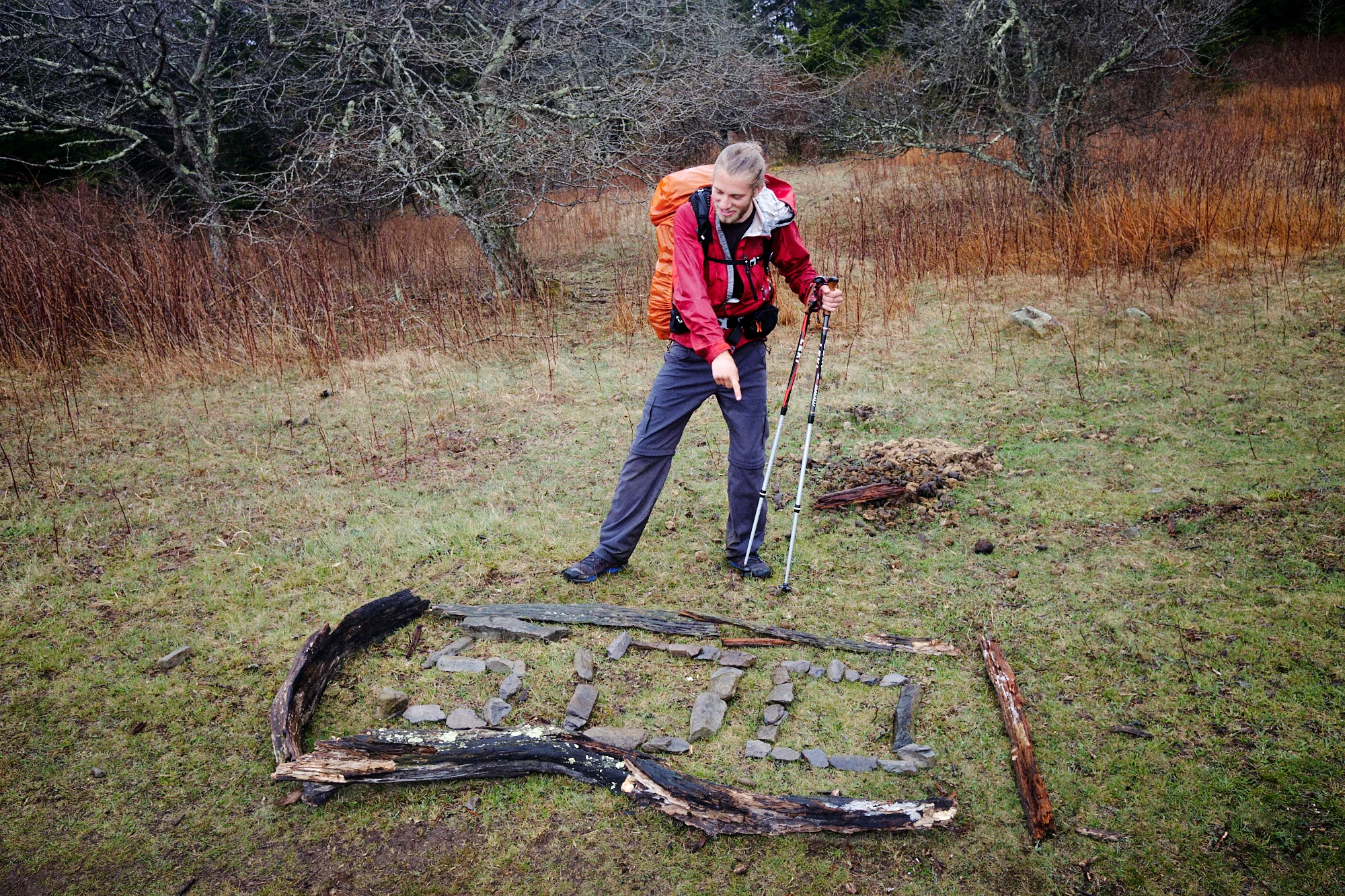
Georgia typically names landmarks in a very boring way, with one exception... | Mile 81.9 NC 3/14/17
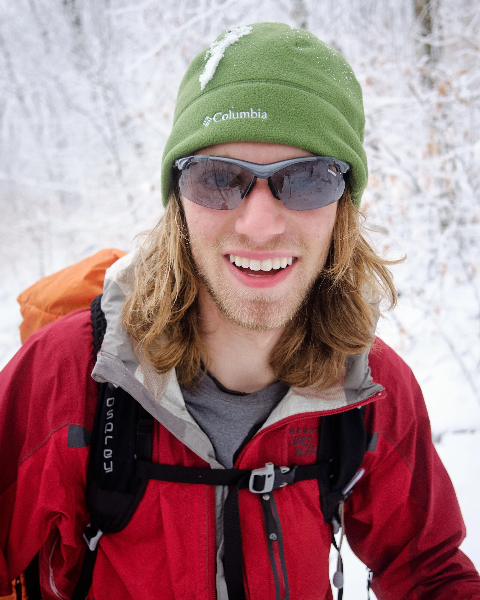
I picked up some ground-score sunglasses at a shelter a couple of days before. Grapenut thought I looked like a Scandinavian explorer and began calling me Dalf. | Mile 81.9 NC 3/14/17
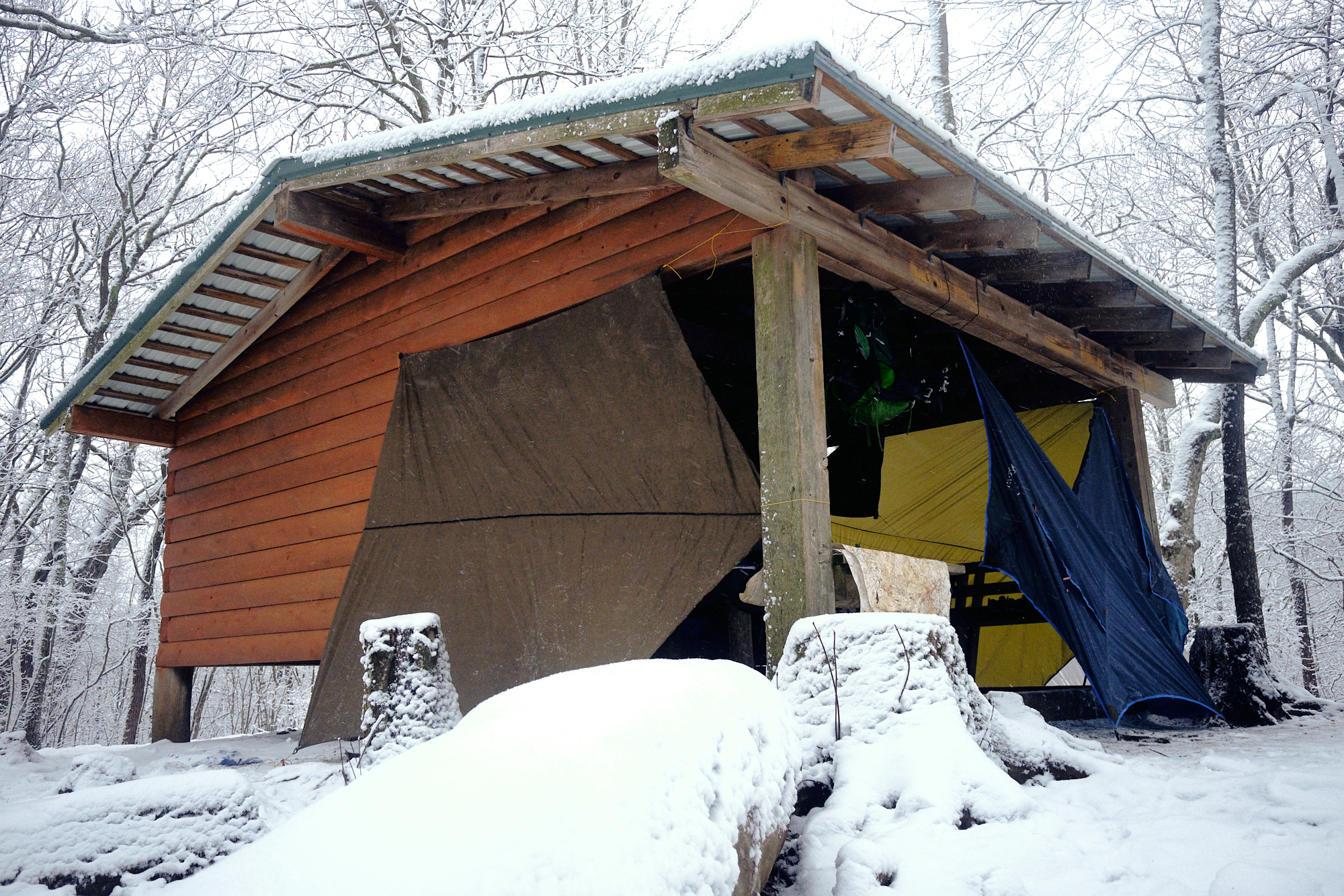
Temperatures and wind reached their worst upon arriving at Standing Indian Shelter. We put up our rainfly's to cut some of the blistering breeze. Water would freeze if left standing for more than an hour, fuel canisters refused to light, and our shoes turned to bricks. | Mile 86.0 NC 3/14/17
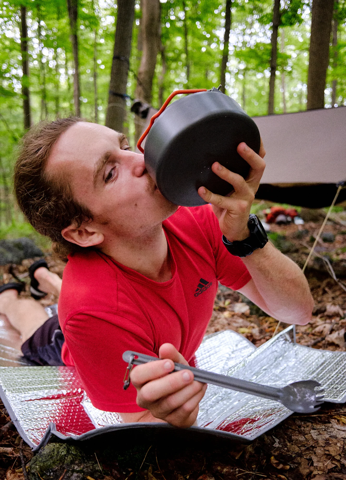
Fishstix, myself and Grapenut wearing every article of clothing we brought, still freezing. We were forced to go out into the storm and hike just to stay warm. Water carried on our packs would freeze solid, so we carried empty bottles from one water source to the next. | Mile 86.0 NC 3/15/17
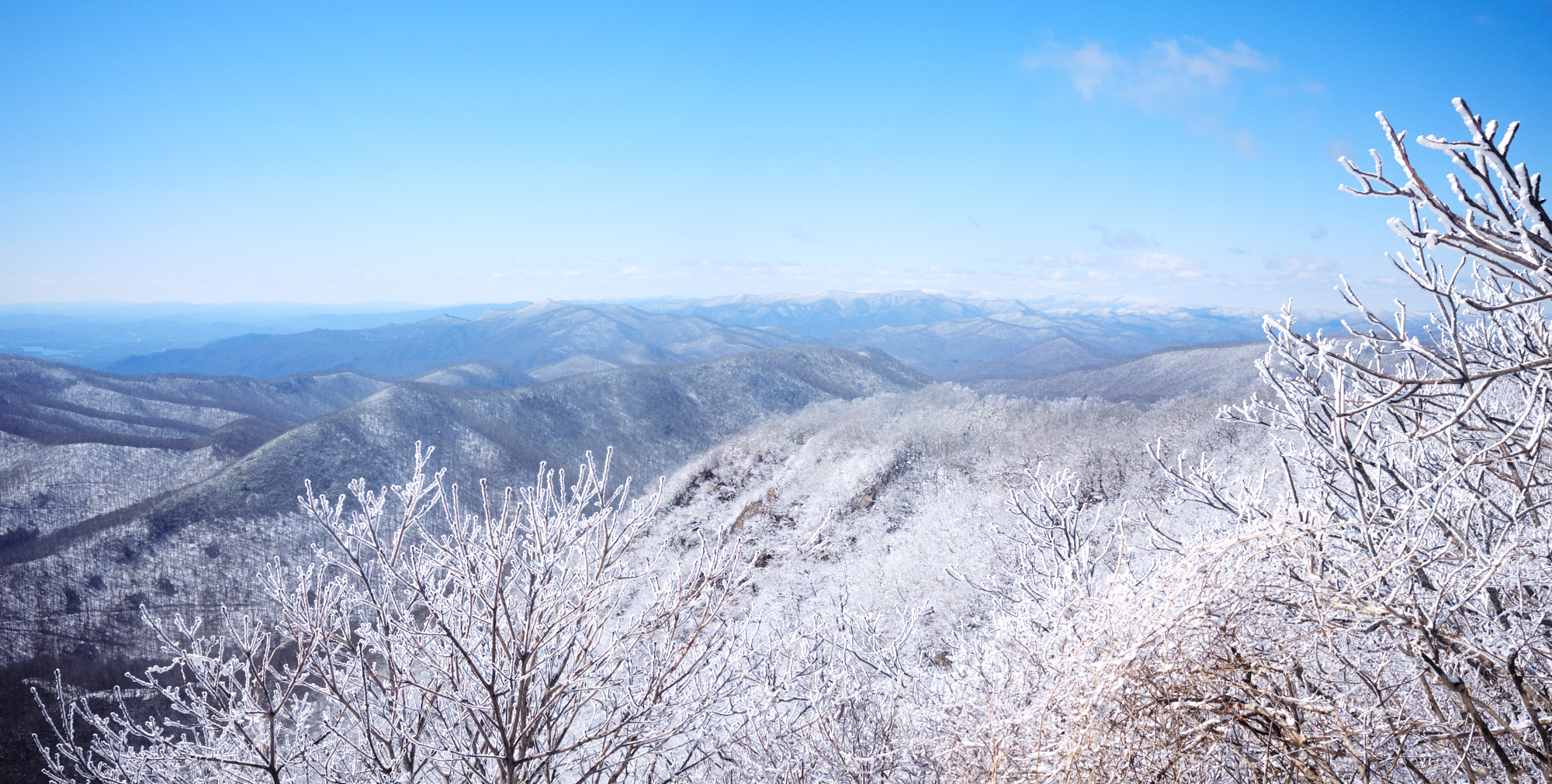
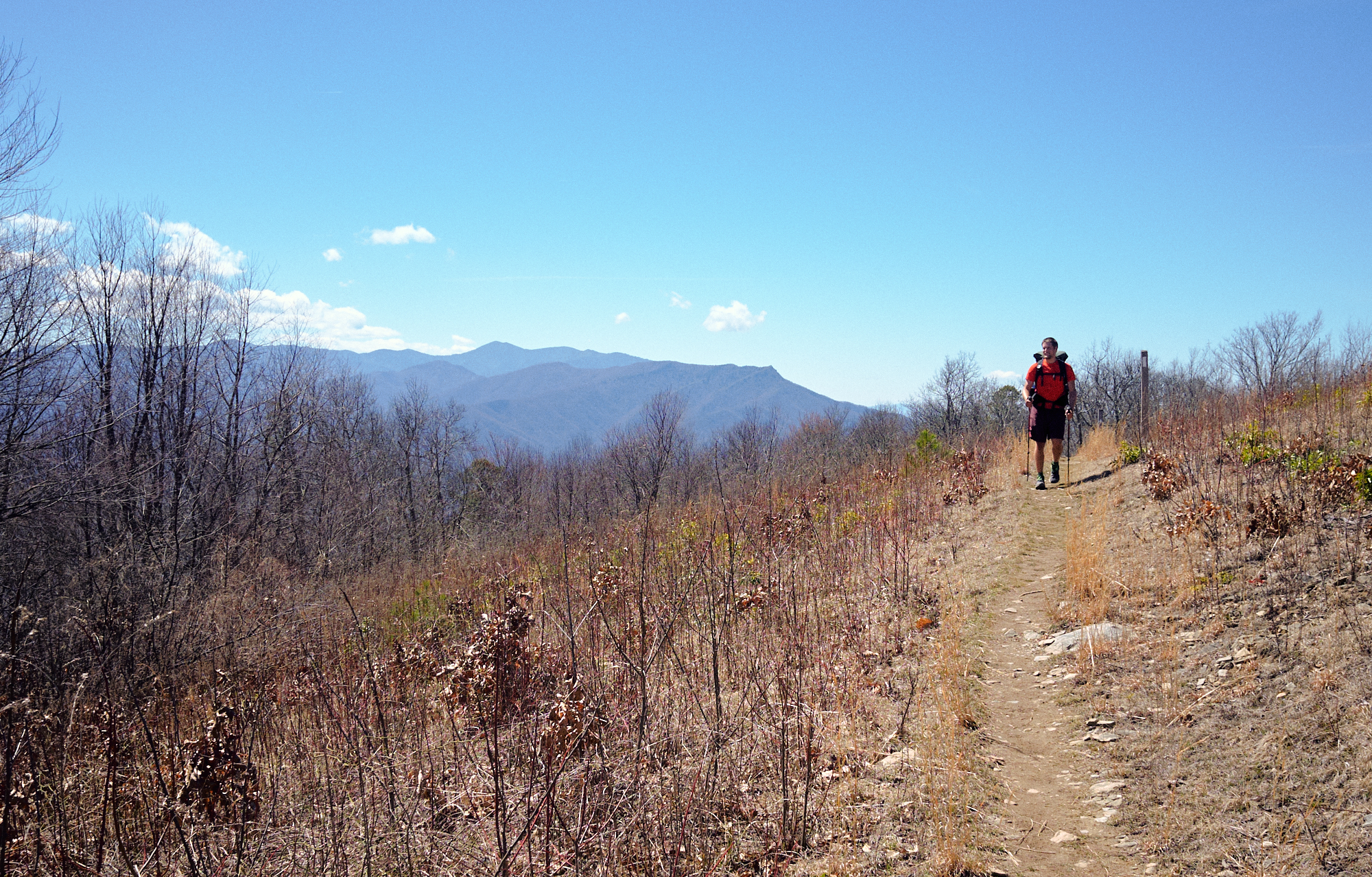
The view from the summit of Standing Indian, our first mile high mountain. A perfectly clear day made for blistering cold, but also phenomenal visibility. In the distance are the Great Smoky Mountains. It was humbling to see such a massive mountain range that we would be hiking through soon incredibly far away yet still so massive. | Mile 87.5 NC 3/15/17
Myself atop Standing Indian, blown away at the fact that I was hiking all the way to those big mountains in the distance. | Mile 87.5 NC 3/15/17
The high altitude, wind and moisture in the air coated all of the trees on the summit with a thick sheet of ice. | Mile 87.5 NC 3/15/17
Grapenut and I atop Albert Mountain. A brutally steep climb led us to the summit. | Mile 99.8 NC 3/16/17
Sassafras Gap Shelter came with high-end amenities. The climb up to this site will always be known to me as the most difficult of the trail. In reality it wasn't that bad compared to the rest of the hike, I just had a less than awesome day. | Mile 143.7 NC 3/19/17
Cheoah Bald, the first bald of the trip. We made it up there for a wonderful sunrise to start the day. | Mile 144.9 NC 3/20/17
Standard Grapenut breakfast: Tortilla with peanut butter and Easter egg candy. Mile 144.9 NC 3/20/17
Grapenut and I on the trail. | Mile ~150 NC 3/20/17
Grapenut setting up at Cable Gap Shelter. | Mile 158.9 NC 3/20/17
The view during a thunderstorm at Fontana Dam, the southern border of the Smokies and the largest dam east of Hoover Dam. This image was taken in the dead of night, it's actually lit entirely by lightning. | Mile 165.6 NC 3/21/17
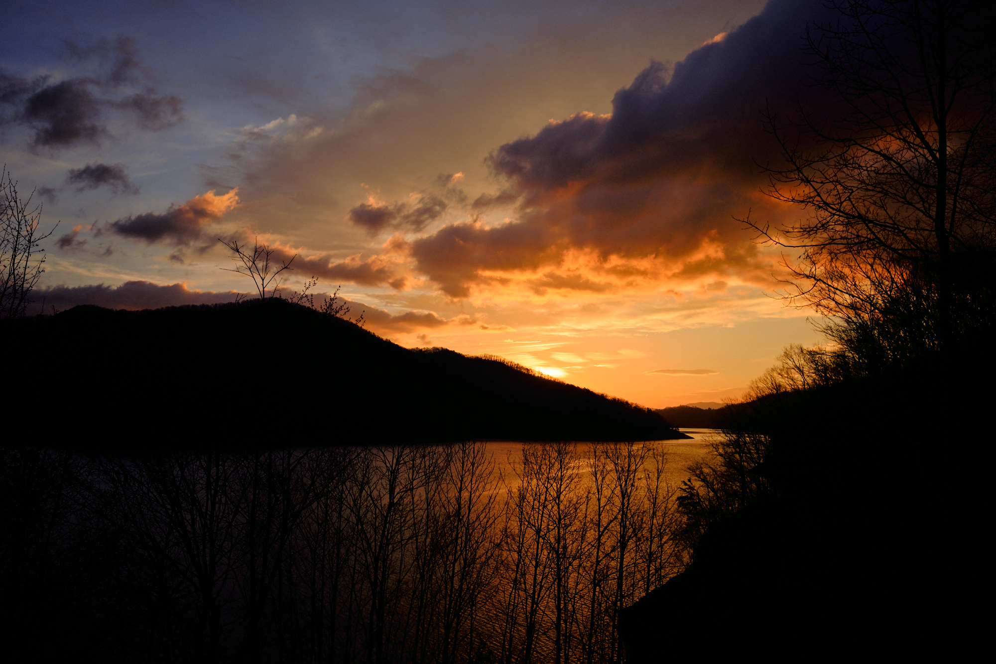
Grapenut and I took 2 zeros at Fontana as we waited for a friend of his to arrive and hike for a few days. We got lucky both nights and had gorgeous sunsets over Lake Fontana. | Mile 165.6 NC 3/22/17
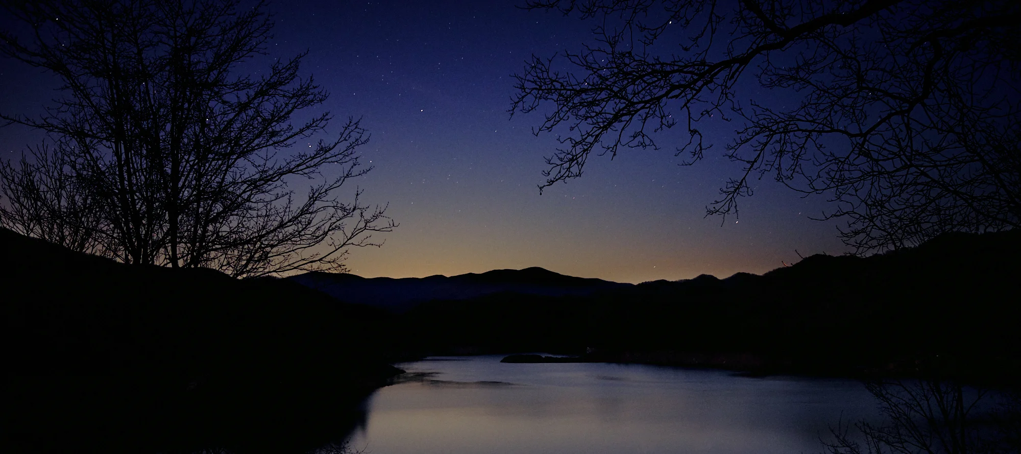
The stars come out above the Great Smoky Mountains and Lake Fontana. | Mile 165.6 NC 3/22/17
Grapenut posing on "The Sawteeth", a series of ridges with exposed, abrupt ascents and descents. | Mile 209.8 NC 3/27/17
Grapenut posing on The Sawteeth, a series of ridges with exposed, abrupt ascents and descents. | Mile 209.8 NC 3/27/17
Myself atop Charlies Bunion, a knob jutting out from a ridge with sheer drops on all sides. | Mile 210.7 NC 3/27/17
Grapenut and I atop Charlies Bunion. | Mile 210.7 NC 3/27/17
My camp for the night after a day of light rain. | Mile 217.1 NC 3/27/17
Grapenut organizes his pack. | Mile 217.1 NC 3/27/17
Mt. Sequoyah, a sub-alpine ridge with a type of forest otherwise only found in Canada. | Mile 219.3 NC 3/28/17
Mt. Cammerer, and the beginning of our descent out of the Smokies. | Mile 232.5 NC 3/28/17
Stateline Branch. | Mile 238.7 NC 3/29/17
Grapenut hiking across Snowbird Mountain. | Mile 244.0 NC 3/29/17
FAA radar tower atop Snowbird Mountain. | Mile 244.7 NC 3/29/17
On the summit of Snowbird Mountain. | Mile 244.7 NC 3/29/17
We camped on Max Patch, one of the largest balds on the entire AT. We got full 360 views and could see light from both Asheville and Knoxville in the distance. | Mile 253.6 NC 3/29/17
Grapenut and I escaping the constant 40 mph winds under my tarp. | Mile 253.6 NC 3/29/17
Camp on Max Patch. | Mile 253.6 NC 3/29/17
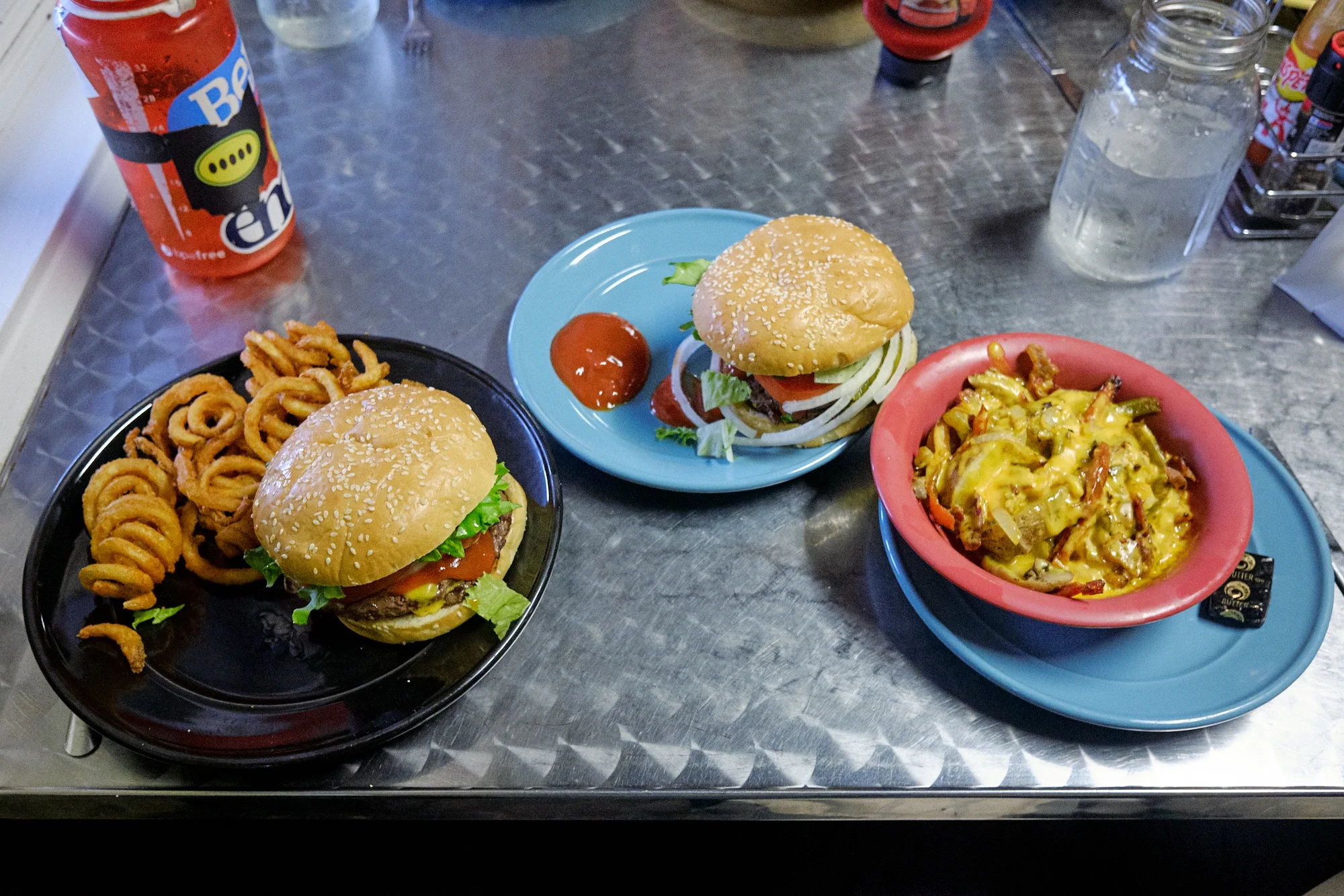
My dinner upon arriving to Hot Springs, NC. Two double cheese burgers, loaded baked potato and fries. | Mile 273.4 NC
Getting out of turrential rain at Little Laurel Shelter. | Mile 293.0 NC 4/3/17
Rain clouds cleared out and made way for a lovely sunset. | Mile 300.3 NC 4/3/17
Big Butt Mountain summit. | Mile 302.2 NC 4/4/17
Licking Lick Rock. | Mile 312.9 NC 4/4/17
Hiking across Big Bald. | Mile 324.3 NC 4/5/17
Having a snack out of the wind. | Mile 325.6 NC 4/5/17
Uncle Johnny's Nolichucky Hostel had a hammock bunkhouse. Very strong winds made for an interesting rainfly set up. | Mile 342.7 TN 4/6/17
Dense Spruce Forest. | Mile 356.5 4/9/17
Unaka Mountain, just shy of the top. A dense spruce forest covered the summit. | Mile 356.5 4/9/17
Laurel Falls after having just hiked 50 miles in two days, a massive accomplishment that early in the hike. | Mile 419.7 TN 4/11/17
Phenomenal rock texture. | Mile 421.2 TN 4/11/17
Camp on top of Pond Flat Mountain. A terrible 1,600 foot climb in 85 degree heat after having just scarfed down 3,070 calories of McDonalds. | Mile 423.8 TN 4/11/17
Grapenut enjoying the view on top of Pond Flats. | Mile 423.8 TN 4/11/17
Pond Flats | Mile 423.8 TN 4/11/17
Pond Flats | Mile 423.8 TN 4/11/17
Wonderful early morning Tennessee views. | Mile 448.3 TN 4/13/17
Damascus is the most welcoming and wonderful trail town, it is also where the Trail Days hiker festival is hosted. We got sucked in, we stayed for 3 days. | Mile 468.7 TN/VA Border 4/13/17
Making dinner under "Megatarp". | Mile 486.4 VA 4/16/17
Mantis has an after dinner snack while talking to Goliath, Ace and Yak. | Mile 486.4 VA 4/16/17
Grapenut brushes his teeth. | Mile 486.4 VA 4/16/17
Grapenut finds a new place to keep his toothbrush easily accessible. | Mile 486.4 VA 4/16/17
A wild pony in the Grayson Highlands licks the sweat from my trekking pole. The ponies were introduced in the 70s to help naturally maintain the highlands, but have become so used to people that they can be a nuisance. | Mile 498.3 VA 4/17/17
Part of the trail known as Fat Man Squeeze. | Mile 499.1 VA 4/17/17
500 miles! | Mile 500.0 VA 4/17/17
Gandalf, Snickers, Couscous (me) and Grapenut at the 500 mile mark. | Mile 500 VA 4/17/17
Grayson Highlands. | Mile 501.4 VA 4/17/17
Fox Creek. | Mile 510.9 VA 4/18/17
These cows followed us while we hiked acros a farmers field just outside of Atkins, VA. We camped just on the edge of the field on the opposite side of a fence. When we woke up, the cows were standing in a straight line along the fence staring at us. They scattered once they realized we saw them. | Mile 545.9 VA 4/19/17
Another farmers field the trail went through. | Mile 554.1 VA 4/20/17
Chestnut Knob Shelter was an old fire wardens cabin that was gutted and turned into a shelter when fire towers became obsolete. The foundation for the fire tower is visible in the bottom middle fo frame. Everything behind the cabin is the Beartown Wilderness. 180 degrees in the opposite direction is a valley known for having some of the most fertile soil in Virginia. | Mile 568.1 VA 4/20/17
A ridge where our right side was completely fogged in, and the left side was a perfectly clear sunny day. | Mile 575.3 VA 4/21/17
Ping Pong and Olde English playing Euchre at Woods Hole Hostel. We stayed there for 3 days while there was a rain storm that was turrential for 48 hours without a break. | Mile 623.7 VA 4/24/17
Ping Pong, Olde English and Two Step. | Mile 626.5 VA 4/25/17
Two Step. | Mile 631.8 VA 4/25/17
The best kind of hike- a hike to a grocery store. Grocery stores were few and far between, when a town was big enough for one it was a momentous occasion. | Mile 634.3 VA 4/25/17
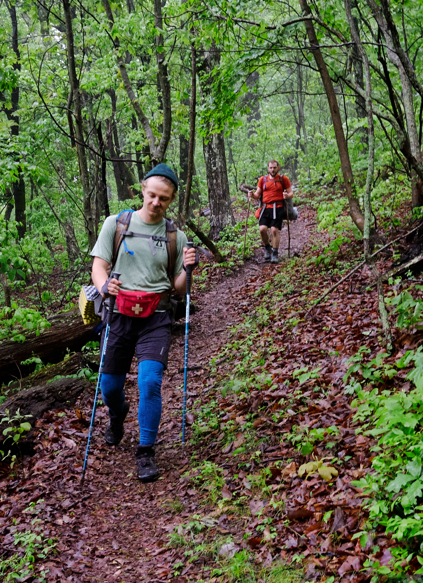
Grapenut, Chili Mac, and Two Step on an exposed ridgeline. | Mile 649.8 VA 4/26/17
Grapenut pulling himself across a river on a zipline. On the opposite bank is The Captain's, a man who allows hikers to camp in his yard and enjoy a fridge stocked full of soda. | Mile 655.9 VA 4/27/17
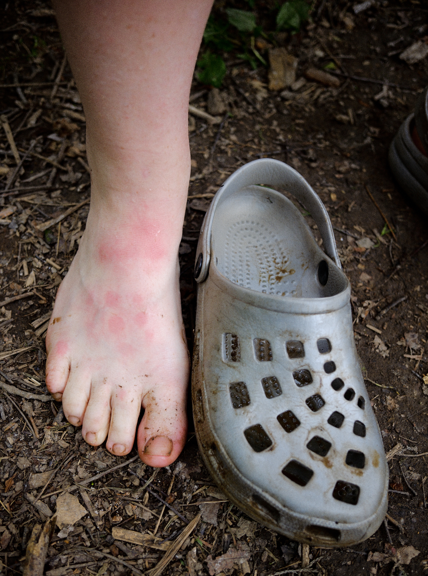
Two Step was having serious foot pain due to some bad shoes. She walked barefoot for a couple of miles, then in her crocs for a couple of miles. She didn't have enough cushion in the crocs, so we put Grapenut's on the outside of hers to add a little extra. She walked another few miles like this until she reached a road to hitch into town and get new shoes. Badass. Chili Mac is pictured in the background, drinking coffee. | Mile 658.6 VA 4/27/17
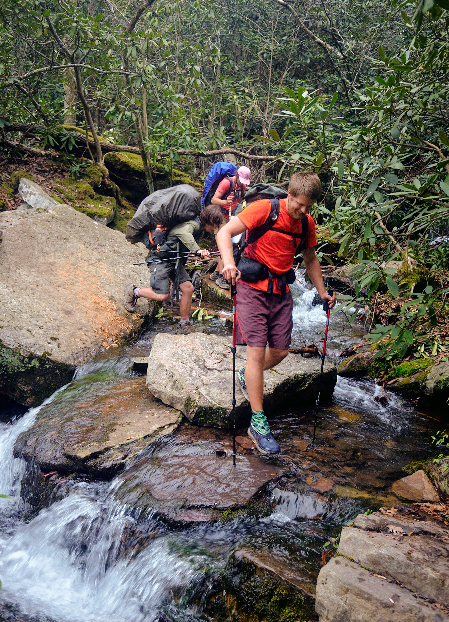
Grapenut, Throwback and Ping Pong ford a small stream. | Mile 673.4 VA 4/27/17
Grapenut helps Olde English move his tent to a better location by the creek. This is at the Bat Ranch, a wonderful property with three caves on it, one of which we went caving in. | Mile 675.7 VA 4/28/17
Grapenut and Olde English playing Stump, my new favorite game. | Mile 675.7 VA 4/28/17
Ping Pong paces in his underwear while on the phone with his Mom. | Mile 675.7 VA 4/28/17
Olde English chomps on a cucumber. | Mile 675.7 VA 4/28/17
Lazer show at the Bat Ranch. There is a diesel powered hot tub the owners built which we enjoyed very much. | Mile 675.7 VA 4/28/17
At the Bat Ranch, we all just wore our crocs rather than shoes. Our feet weren't used to seeing sun, and Two Step, the palest of the bunch got sunburned. | Mile 675.7 VA 4/28/17
Eastern Continental Divide. Just a short 400 mile side hike to the ocean! | Mile 682.9 VA 4/30/17
Dragons Tooth stone monolith. A big storm was rolling in, so we booked it on the way down from here. It was poorly blazed and we took the wrong trail down a steep descent, realized, and had to climb back up. The correct descent was so brutal it gave me pain that lasted for 1,000 miles. At least it was pretty up there! | Mile 699.9 VA 5/1/17
On top of Dragons Tooth. This is the moment I looked to the west and saw the dark storm clouds coming our way. In the background is Brush Mountain, where we had hiked from earlier that day. | Mile 699.9 VA 5/1/17
McAfee Knob, one of the best views on the trail. The trail follows the ridge that runs along the center of the frame to Tinker Cliffs, another phenomenal view. Just behind the rock I'm sitting on is Roanoke, VA. | Mile 712.0 VA 5/2/17
View from the other side of McAfee Knob. | Mile 712.0 VA 5/2/17
Grapenut and I enjoying the view. | Mile 712.0 VA 5/2/17
About time someone said something, even if it is just more graffiti. | Mile 712.7 VA 5/2/17
As is tradition, I'm peeing off Tinker Cliffs. Strong winds made for some bad spray. | Mile 717.6 VA 5/2/17
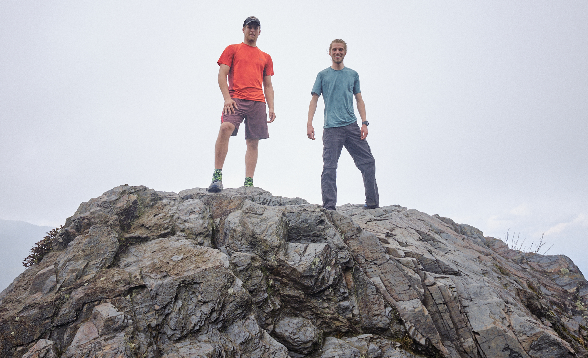
Lucas and Al came to hike 60 miles with Grapenut and I. Their trail names would become Whittler and Supple. | Mile 733.1 VA 5/3/17
Supple and Whittler setting up camp for the night in a gorgeous little holler. In the 1800s, this area was used for mass charcoal production furnaces. | Mile 738.8 VA 5/3/17
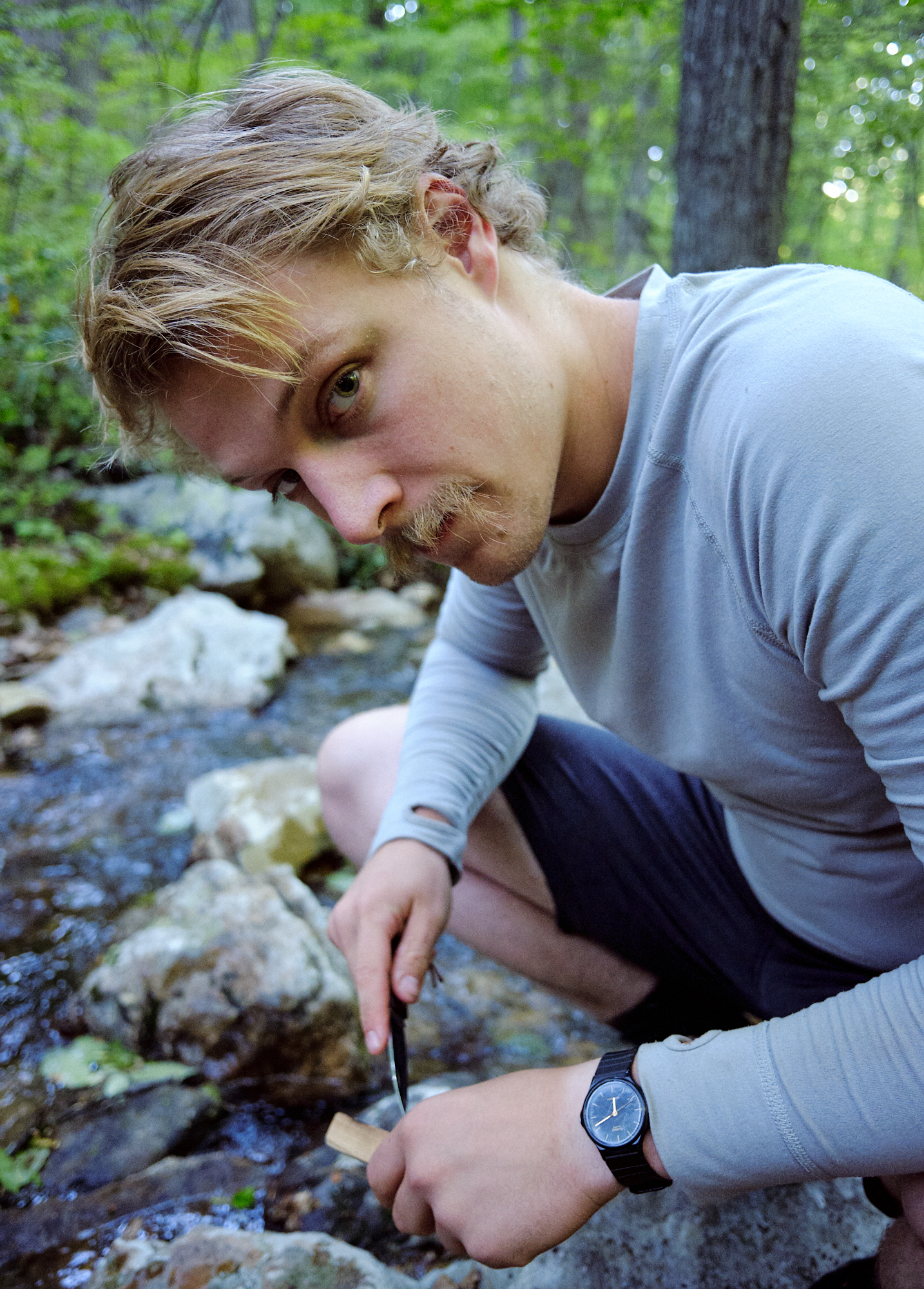
Whittler whittling by a creek. | Mile 738.8 VA 5/3/17
Whittler and Supple trucking along. | Mile 757.9 VA 5/5/17
Whittler enjoys Blackrock view and figures out which mountains we crossed over in the distance. | Mile 765.9 VA 5/5/17
Grapenut challenges the 40 mph winds to step it up. | Mile 771.7 VA 5/6/17
Whittler enjoys the view and laughs about how ridiculous the wind is. | Mile 771.7 VA 5/6/17
Supple also enjoys the view and the weather. | Mile 771.7 VA 5/6/17
Whittler and Supple ready for another day of hiking. | Mile 773.5 VA 5/6/17
Mile 739.8 VA 5/8/17
Camp for the night. | Mile 804.9 VA 5/8/17
Mile 833.8 VA 5/10/17
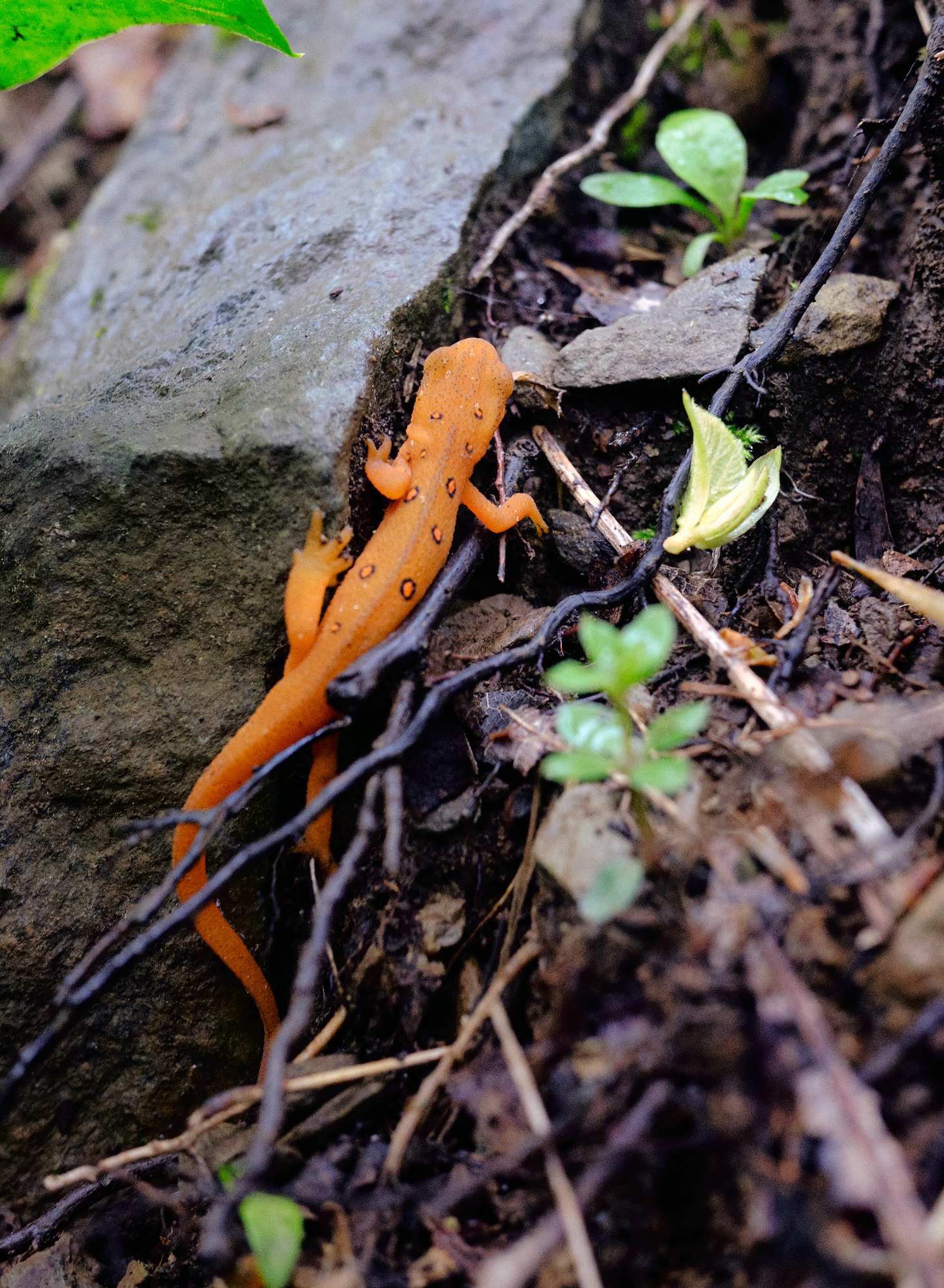
A Red Spotted Newt, seen on almost the entire length of the trail. As the newt gets older, it turns green and transitions to living in water full time. | Mile 841.1 VA 5/11/17
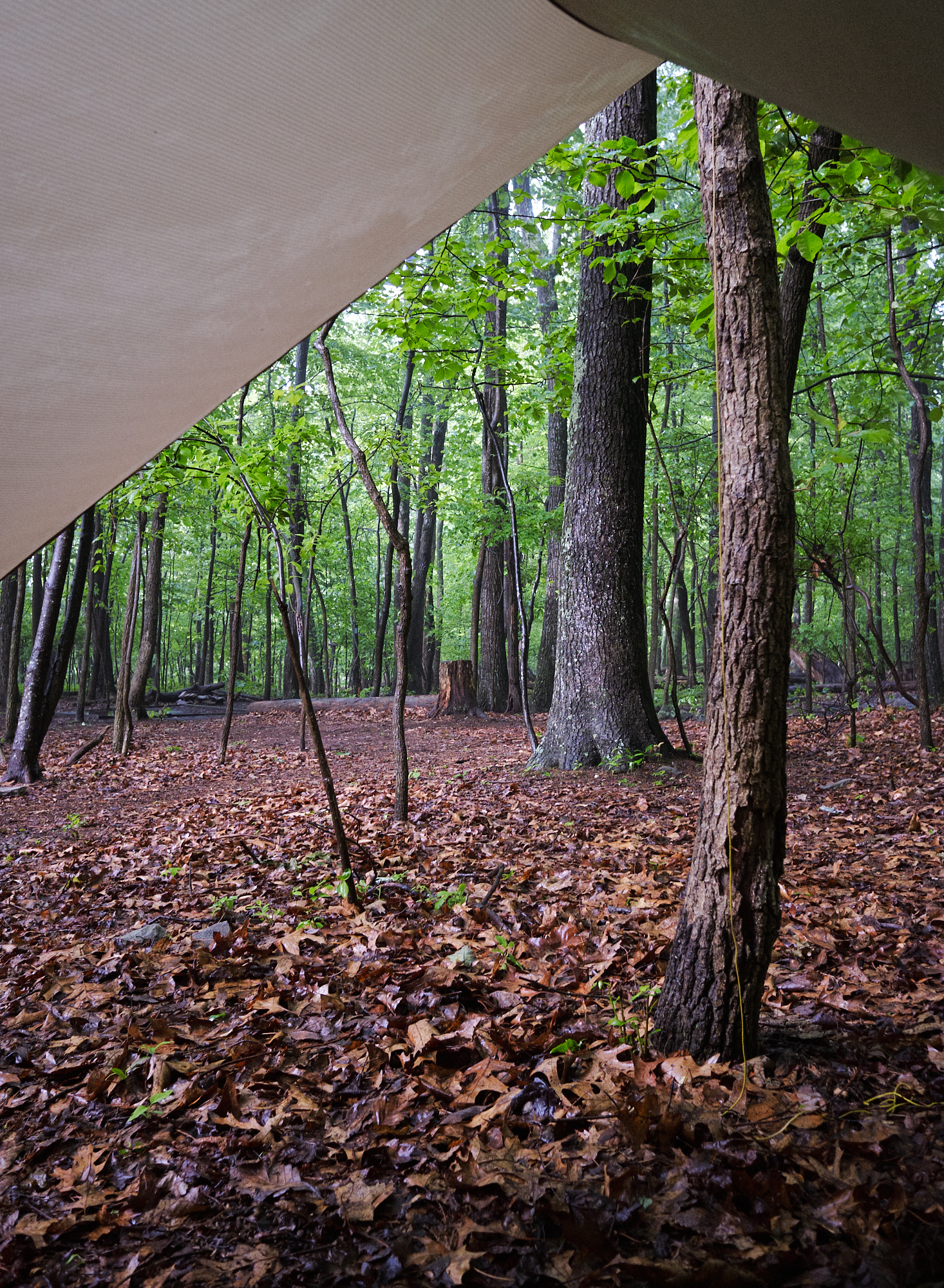
Just before entering Shenandoah National Park, we stopped in to Waynesboro, Virginia. They had a thru hiker campsite on the edge of town, but there was no water source. Thankfully, it was raining. | Mile 861.9 VA 5/12/17
Grapenut does some mustache maintenence. | Mile 900.7 VA 5/15/17
The trail followed Skyline Drive for .1 miles, and crossed US 33, which ultimately goes straight back home to Athens. | Mile 907.4 VA 5/15/17
Grapenut on Little Stony Man Cliffs looking down on Luray, VA. | Mile 933.5 VA 5/16/17
Myself on Little Stony Man Cliffs. Behind me is the highest point in Shenandoah National Park, a measly 3,837 feet. | Mile 933.5 VA 5/16/17
Sunset from Byrds Nest #3 Hut. | Mile 938.8 VA 5/16/17
The view from Mary's Rock. | Mile 940.1 VA 5/17/17
The view from Mary's Rock. | Mile 940.1 VA 5/17/17
Kaleidoscope basking in the sun. | Mile 952.1 VA 5/17/17
I had my first fall and cut up my elbow. I didn't even realize for two miles. | Mile 969.7 VA 5/19/17
We stayed at a hostel with no trees for hammocking, so I became a ground dweller for the night. | Mile 969.7 VA 5/19/17
1,000 miles!! | Mile 1,000.0 VA 5/24/17
Camp after completing the Roller Coaster, a brutal 13.5 miles of abrupt ascents and descents. Total mileage for the day was 24. It was also my final mile in Virginia, and since 1/4 of the trail is there it was a big moment. | Mile 1,014.4 WV 5/25/17
The Potomac River. | Mile 1023.5 WV 5/25/17
Small snake! Found at the beginning of the Four State Challenge, where I hiked starting one foot in Virginia, four miles in West Virginia, 38 miles in Maryland, and finishing in Pennsylvania all in 24 hours. 43 miles total. | Mile 1,030.1 MD 5/26/17
Sunrise over a Civil War battlefield as I wrapped up the four state challenge. Only nine miles to go from this point. | Mile 1,058.7 MD 5/27/17
The end of both the four state cahllenge and the south. | Mile 1,064.6 PA 5/27/17
43 miles worth of dirt in camp after completing the four state challenge. | Mile 1,065.2 PA 5/27/17
Falls Creek. | Mile 1065.2 PA 5/27/17
Camping at Falls Creek. | Mile 1,065.2 PA 5/27/17
Sunset at Falls Creek. | Mile 1,065.2 PA 5/27/17
Halfway sign! Fun fact, this isn't actually halfway, since the trail changes a little bit each year. The 2017 halfway point is about four miles north. | Mile 1,090.5 PA 5/30/17
Captain Jack blows bubbles on the porch of Trail Angel Mary's in Duncannon, PA. | Mile 1,147.2 PA 6/2/17
Trail Angel Mary and Not Tonight enjoying some people watching on the porch. Trail Angel Mary is one of the most inspiring people I have ever met. She allows thru hikers to stay in her home and relax during their time in Duncannon. | Mile 1,147.2 PA 6/2/17
Isaac came to walk for a few days with me, his trail name became Sloth. | Mile 1,230.8 PA 6/5/17
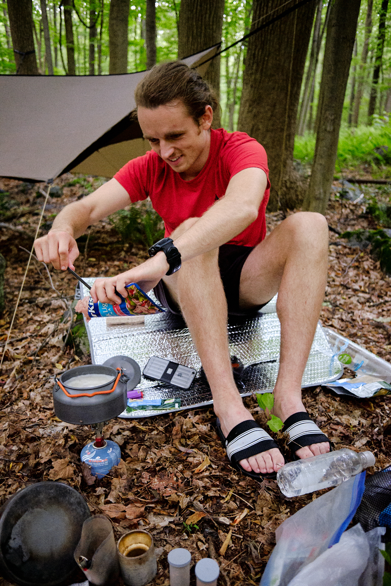
Sloth, new to the backpacking game, added a bit too much water to his ramen. | Mile 1,230.8 PA 6/5/17
Pennsylvania, otherwise known as Rocksylvania. This is what the trail looked like in much of the state. | Mile 1,243.1 PA 6/6/17
Sloth and I hiking the Knife Edge, an exposed stretch of very steep rock slabs. | Mile 1,247.0 PA 6/6/17
The knifes edge. | Mile 1,247.0 PA 6/6/17
A lovely side scenic trail. | Mile 1,255.5 PA 6/7/17
Sloth and I about to ascend a 1,000 foot rock scramble, the first on the trail. Soon, this would be what the trail was all the time. | Mile 1,258.8 PA 6/7/17
The trail. | Mile 1,258.8 PA 6/7/17
I found this smiley face on the trail. It remained on my pack for the rest of the hike. | Mile 1,262.7 PA 6/7/17
Sloth eagerly waits for his water to boil. | 1,267.5 PA 6/7/17
Our final selfie, largely to show off my new groundscore hat. I wore it all the way to Katahdin. | Mile 1,277.1 6/8/17
I camped on an exposed ridgeline that was popular with paragliders, two of them were getting in the air for the final time when I arrived. | Mile 1,287.5 PA 6/8/17
Cooking dinner. | Mile 1,287.5 PA 6/8/17
The summit of Kittatinny Mountain. | Mile 1,302.0 NJ 6/12/17
Unnamed swamp. | Mile 1,307.9 NJ 6/13/17
Mountain Laurel, one of the most abundant plants on the trail. | Mile 1,307.9 NJ 6/13/17
Sketchy water source to say the least. | Mile 1,317.9 NJ 6/13/17
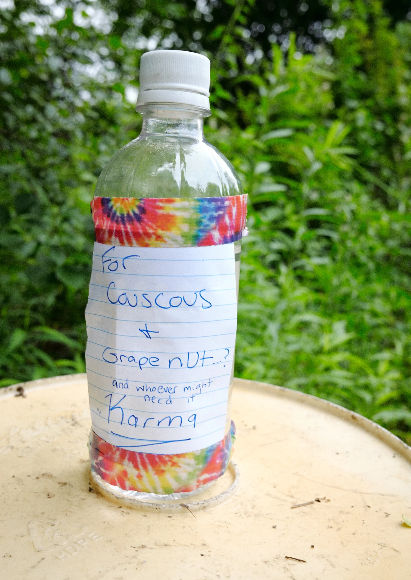
The night before we met a couple of trail maintainers who were bringing water to a shelter that didn't have a source. My water filter was clogged, and it can be cleaned with vinegar. Karma, the maintainer, said that her Mom lived right down the street and drives past a trailhead on her way to work that we would pass the following day. When we got to the trailhead, this was waiting for us, along with some other water and food. She was a true trail angel. | Mile 1,362.4 NJ 6/16/17
New Jersey- New York Border. | Mile 1,366.0 NJ/NY 6/16/17
New Jersey- New York Border. | Mile 1,366.0 NJ/NY 6/16/17
Some border yoga. | Mile 1,366.0 NJ/NY 6/16/17
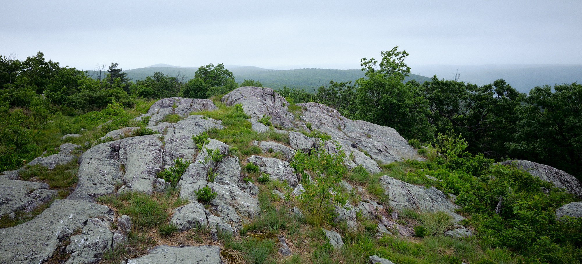
Prospect Rock, the highest point on the AT in New York at a pitiful 1,433 feet. At least it was absolutely gorgeous! | Mile 1,366.4 NY 6/16/17
Grapenut lounges on a bench as we wait for a ride. | Mile 1383.9 NY 6/17/17
Fingerboard Shelter had no water source, but a storm was coming and there was a lot of trash scattered about. We jerryrigged this device and had more water than we knew what to do with. It tasted like roof, though. | Mile 1,388.3 NY 6/19/17
A view of the New York City skyline from Black Mountain, around 40 miles away. Pretty crazy to think that from our location in the middle of nowhere, we were staring at nearly 9 million people. | Mile 1,394.9 NY 6/20/17
Nuclear Lake, formerly used as a test site for the Manhattan Project. Needless to say, I did not drink that water. It was also on this very sad day that I saw Grapenut for the final time. | Mile 1,442.7 NY 6/22/17
A classic New York marshmallow farm. | Mile 1,495.7 CT 6/25/17
Mile 1,509.7 CT 6/26/17
After a few hundred miles of tiny mountains, finally something substantial. | Mile 1,509.7 CT 6/26/17
Springer, a puppy walking with her owner Billy Goat. | Mile 1,509.7 CT 6/26/17
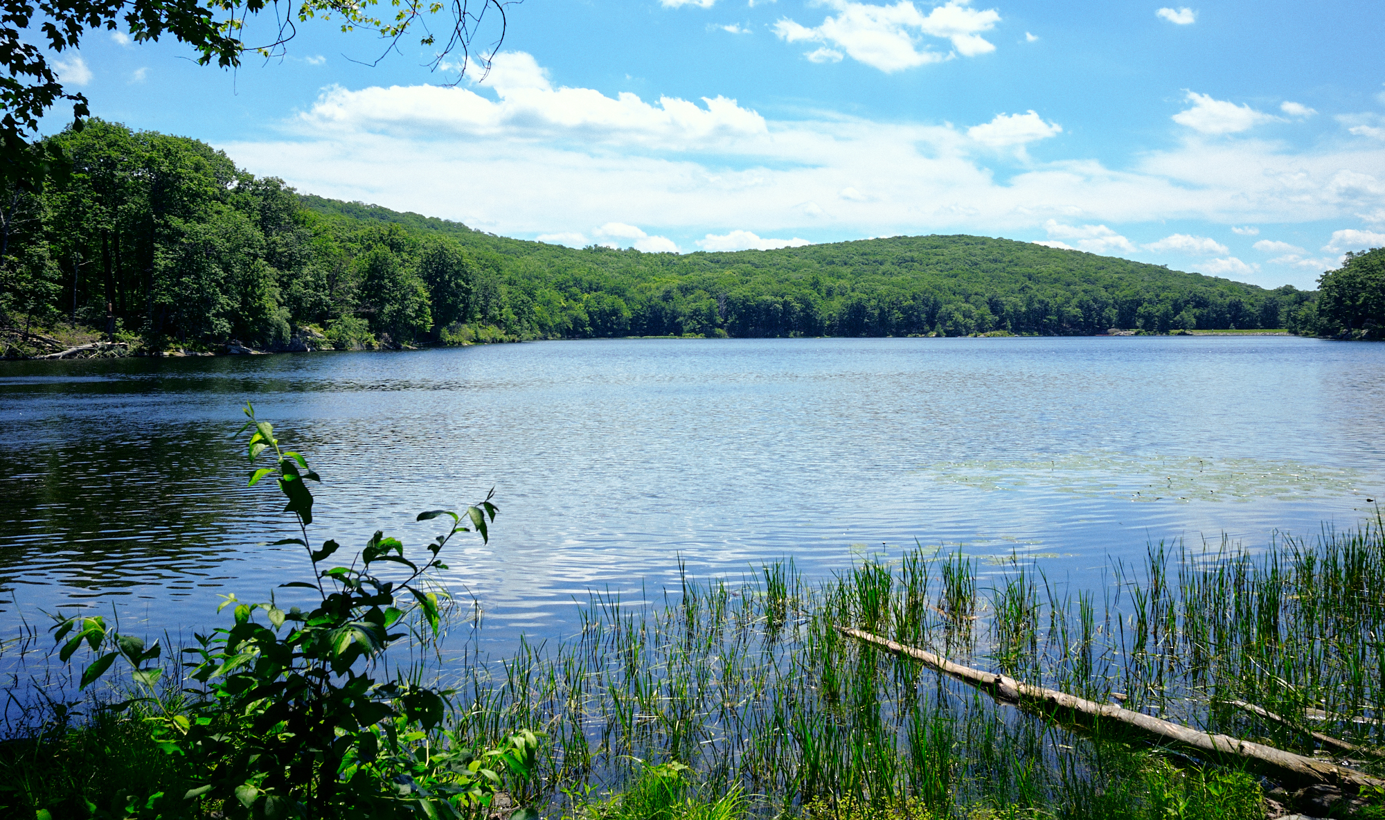
Benedict Pond. | 1,531.1 MA 6/26/17
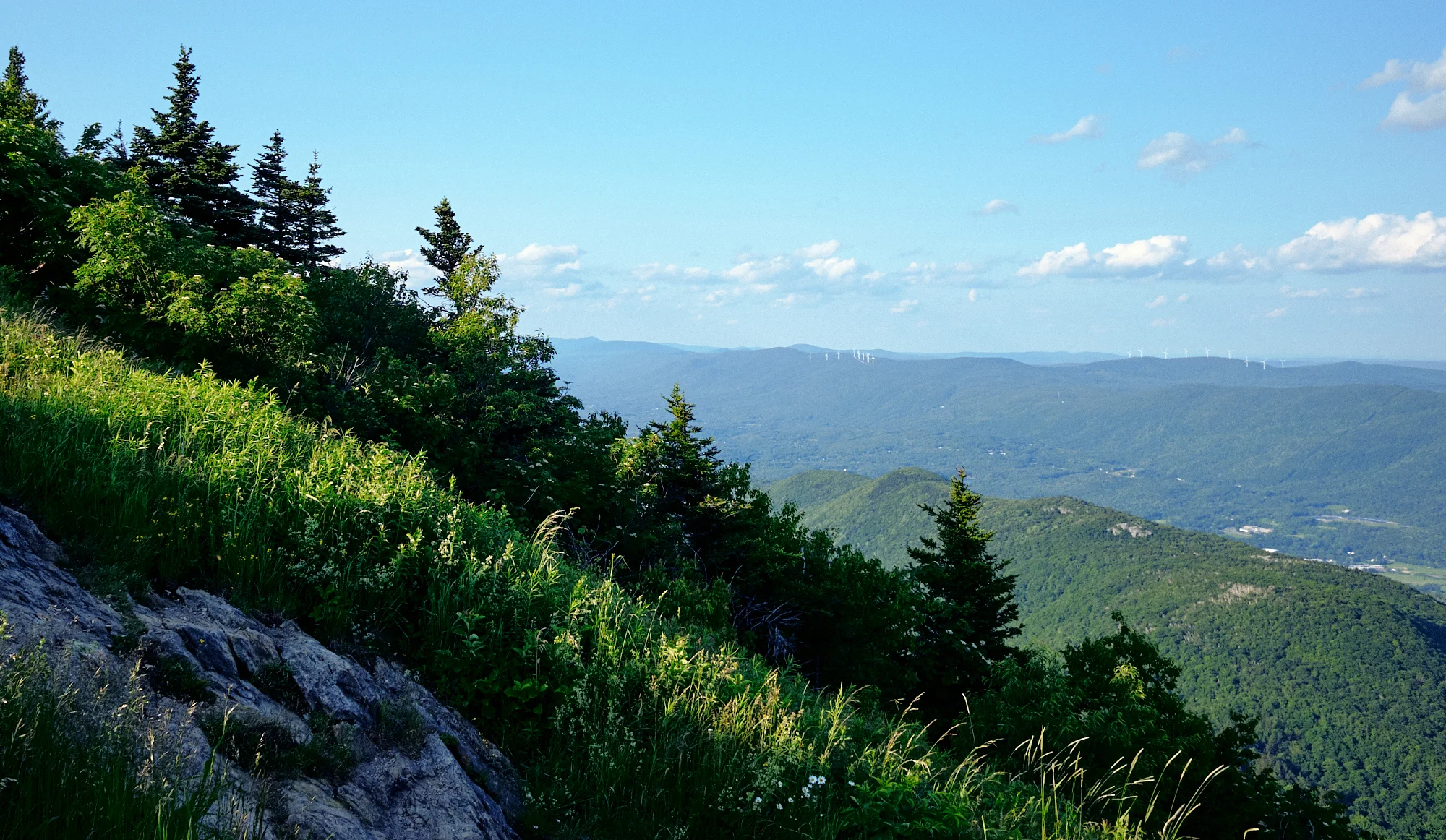
The summit of Mt. Greylock, the highest peak in Massachusetts. In the distance, Vermont is visible. | Mile 1,585.9 MA 6/28/17
The view from Glastenbury Mountain lookout tower. Alpine zones, here I come. | Mile 1,621.0 MA/VT 6/30/17
Sock drying apparatus. Moments after this image was taken, two inches of rain fell in an hour. Good thing I was in a hammock, because I was over a puddle! | Mile 1,633.2 VT 6/30/17
The view from Stratton Mountain. It was on this summit that Benton McKaye was insprired to create the Appalachian Trail. | Mile 1,637.0 VT 7/1/17
My brother Gabriel, trail name Cropduster, ascends Bromley Mountain with my Dad, trail name Mr. Cous in the background. Bromley Mountain is a ski slope in the winder, hence the unobstructed path. | Mile 1,653.7 VT 7/2/17
Cropduster on Baker Peak, one of the most beautiful views in Vermont. | Mile 1,659.5 VT 7/3/17
Mile 1,659.5 VT 7/3/17
Thundering Falls. | Mile 1,706.2 VT 7/4/17
My view for the night atop Ascutney Mountain. | Mile 1,723.3 VT 7/4/17
Surly crossing Barnard Brook. Trail magic consisting of sodas was awaiting on the other side. | Mile 1,726.7 VT 7/5/17
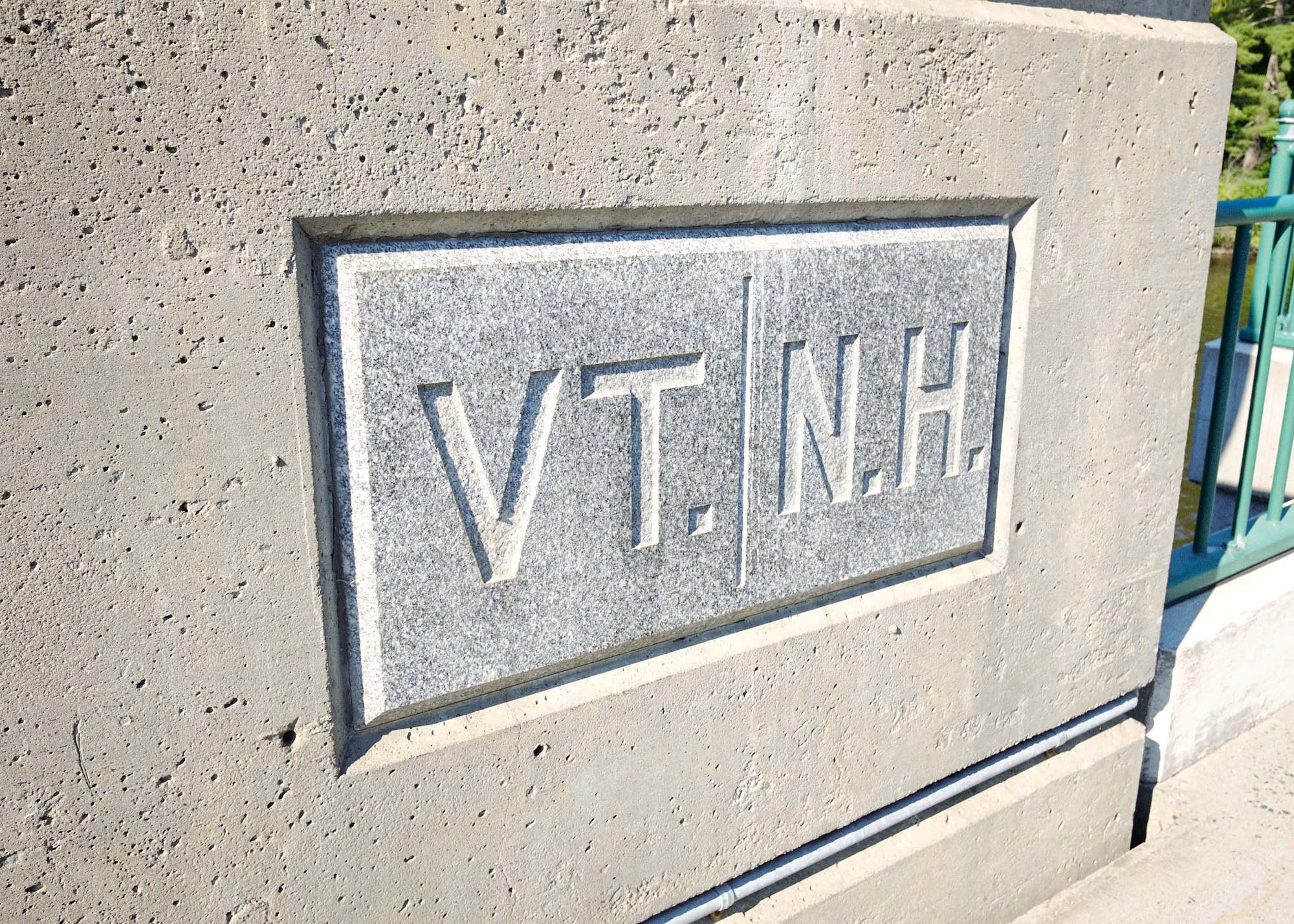
Vermont was gorgeous, but crossing into New Hampshire meant hiking the White Mountains, and the beginning of the end of the hike. Crossing the border was a road walk that took us through the quintessential New England town of Norwich, VT and into Hanover New Hampshire, home of Darmouth College. | Mile 1,747.1 VT/NH 7/5/17
That Guy and myself posing on the green of Darmouth College looking far scruffier than anyone else around. We stealth camped in the woods attached to a country club. | Mile 1,747.7 NH 7/6/17
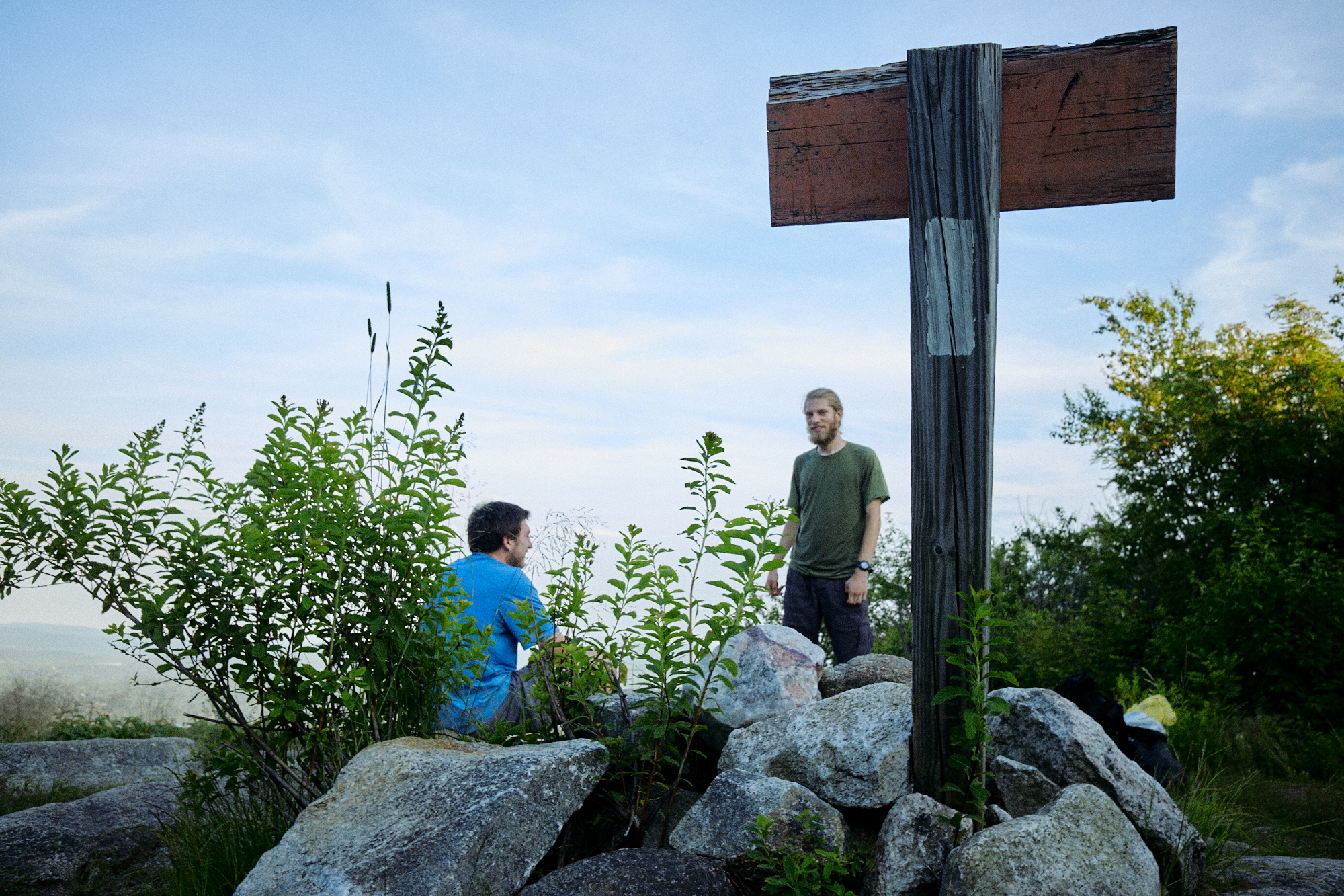
Shutter and myself enjoying the view on Moose Mountain south peak. | Mile 1,757.8 NH 7/6/17
Two Step eats lunch in the fire tower on Smarts Mountain. From up here we could see the White Mountains for the first time. | Mile 1,770.9 NH 7/7/17
Mt. Cube south peak. | Mile 1,777.9 NH 7/7/17
The first of many vertical rock slabs the trail went up. | Mile 1,777.9 NH 7/7/17
Welcome to the Whites! Here's a river to ford. | Mile 1,791.1 NH 7/8/17
The trail coming down the north side of Mount Moosilauke. | Mile 1,800.2 NH 7/9/17
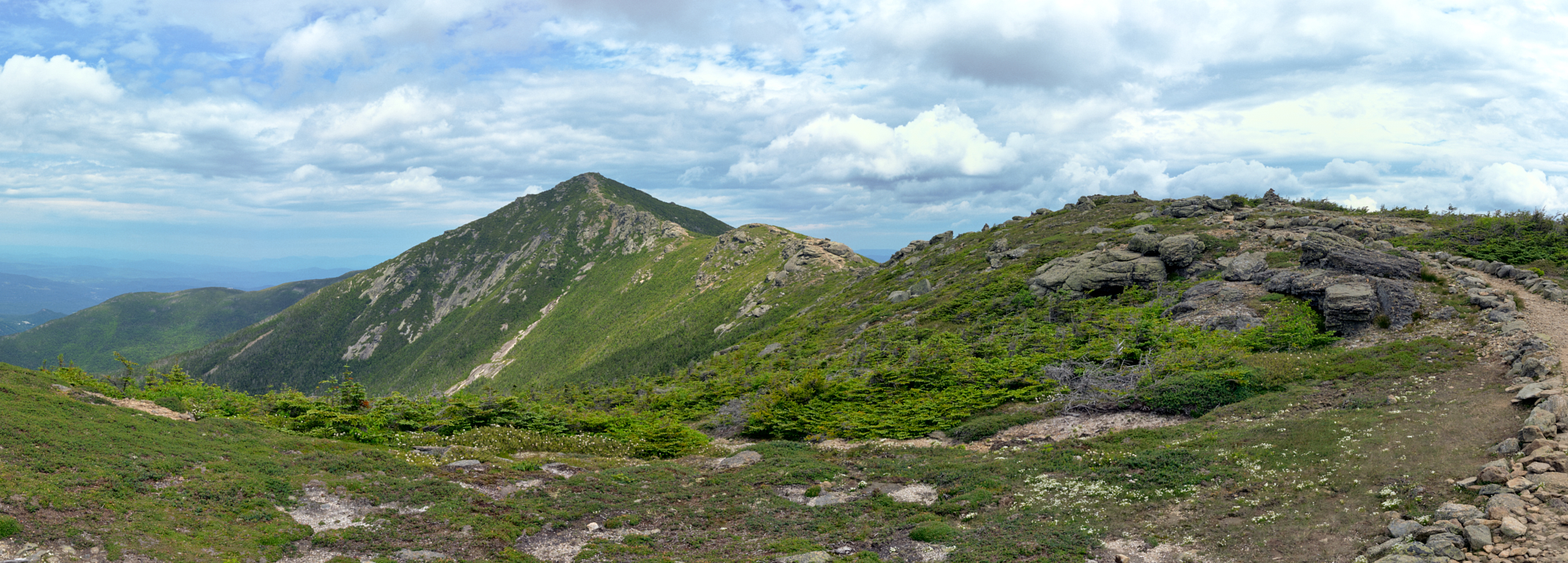
The view from South Kinsman mountain, one of my favorite rock scrambles of the entire hike. The trail would later cross many of the mountains in view. | Mile 1,810.4 NH 7/9/17
Lonesome Lake, with Mt. Lafayette and the Franconia Ridge in the distance. | Mile 1,813.7 NH 7/9/17
Cascade Brook. | Mile 1,813.7 NH 7/9/17
The view from Little Haystack Mountain. | Mile 1,821.4 NH 7/10/17
Mt. Lincoln, part of the Franconia Ridge with Mt. Lafayette in the distance. Most of the high peaks in the Whites are above treeline. | Mile 1,822.1 NH 7/10/17
Enjoying the view from Webster Cliffs. | Mile 1,846.8 NH 7/1//17
Mt. Pierce. | Mile 1,851.6 NH 7/11/17
Mt. Franklin. | Mile 1,854.4 NH 7/11/17
A reassuring sign at the beginning of the ascent up Mt. Washington, the second highest peak on the AT at 6,288 feet. | Mile 1,856.9 NH 7/12/17
This was all I could see in much of the Whites: fog, rocks, and poorly marked trails. | Mile 1,856.9 NH 7/12/17
The back side of Mt. Washington. I accidentally went down the wrong "trail", which was an 80 degree incline with loose rock and running water. I made it 1,500 feet down the mountain, realized I wasn't on the AT, and had to climb back up. This image truly doesn't do the severity of the drop justice. | Mile 1,857.7 NH 7/12/17
Dream Lake. | Mile 1,901.2 NH 7/14/17
Alpine zone trail. | Mile 1902.0 NH 7/14/17
I made it to Maine! Only 280 miles to Katahdin. | Mile 1,908.0 NH/ME 7/15/17
Mahoosuc Notch, a mile long boulderfield. See that black hole in the middle of frame? I crawled out of that. | Mile 1,914.5 ME 7/15/17
Baldpate west peak, with the east peak just a bit further. | Mile 1,925.7 ME 7/16/17
Olde English summits Baldpate east peak. | Mile 1,926.6 ME 7/16/17
On the summit of Baldpate east peak. | Mile 1,926.6 ME 7/16/17
Completing my evening chores after a muddy day. I was also sick and short on food, which made for a very sad time. | Mile 1,951.7 ME 7/17/17
Chopstix and Olde English waiting for a car to drive by on a seldom traveled Maine highway. | Mile 1,969.4 ME 7/18/17
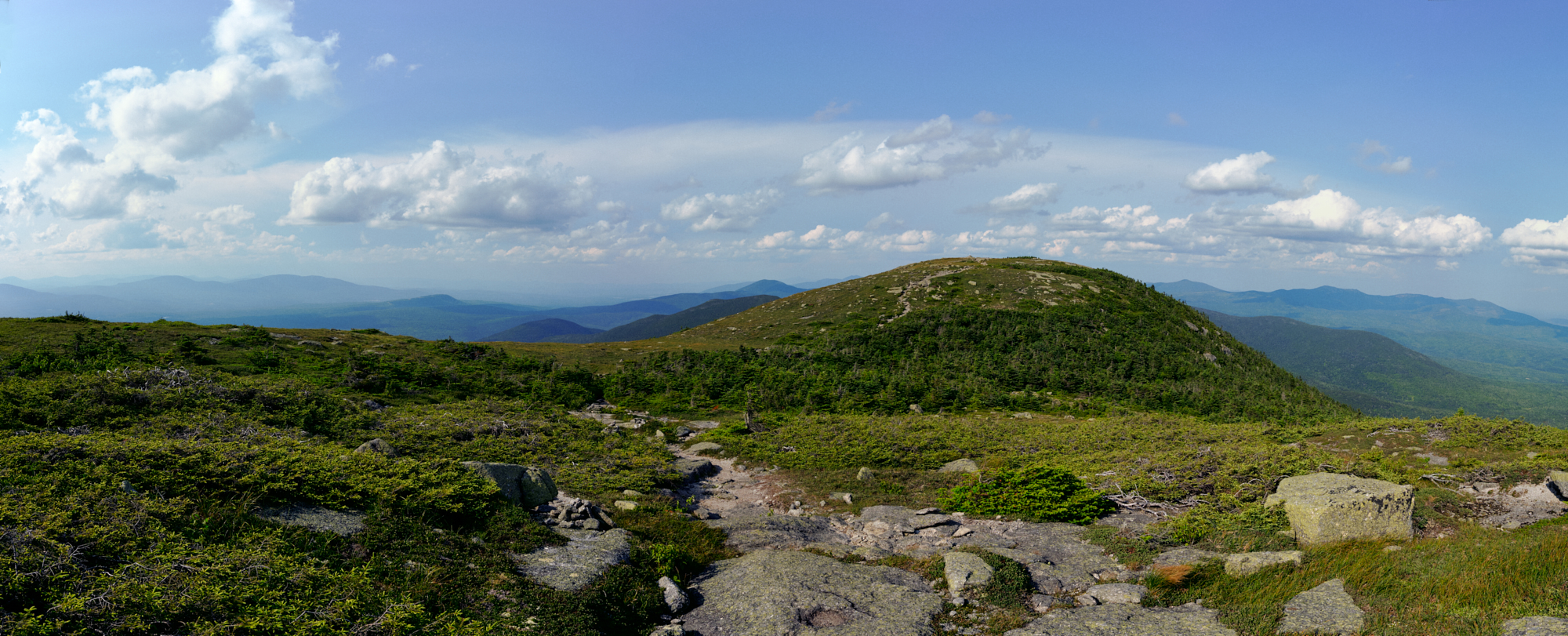
The climb to the summit of Saddleback Mountain, which was above treeline. | Mile 1,975.1 ME 7/21/17
The Horn. | Mile 1,976.7 ME 7/21/17
Olde English and Chopstix finish their descent from The Horn. | Mile 1,977.0 ME 7/21/17
Sunset shining through the clouds of an incoming storm. | Mile 1977.0 ME 7/21/17
Enjoying a dip in Carrabasset River. | Mile 1,993.2 ME 7/22/17
The summit of Bigelow Mountain. We got incredibly lucky and hit this location on a super clear day. It was so clear that we were able to clearly see Mt. Katahdin from nearly 100 miles away, which was the first time we had the privilege of looking at it. It was both massively motivational and quite depressing; the end was literally in sight. Katahdin is the very faint, flat topped mountain on the horizon a little less than 1/4 of the way from the left edge. | Mile 2,009.3 ME 7/23/17
East Carry Pond. | Mile 2,028.3 ME 7/24/17
Maine truly was a wonderland. | Mile 2,035.2 ME 7/24/17
Gung-ho for fire safety. | Mile 2,038.6 ME 7/24/17
Chopstix diligently removes a small silica drying agent bead from his headphone jack in a position known only to true professionals. | Mile 2,038.6 7/25/17
Easily my favorite hang, I strapped up right on the edge of a 20 foot deep crack in a rock with a creek running through it. I've slept on a lot of rocks and next to a lot of creeks, but the unique beauty of this site was simply mezmerizing. | Mile 2,053.3 ME 7/25/17
Moxie Bald, and our second Katahdin sighting, this time about 20x larger in our view. It is in the distance, center of the frame. | Mile 2,055.3 ME 7/26/17
Two Step had lost so much weight over the last couple of weeks that her hip belt no longer fit. She created spacers out of her crocs and all was well. | Mile 2,068.6 ME 7/26/17
Just outside of Monson, Maine was the beginning of the 100 Mile Wilderness. | Mile 2,075.3 ME 7/26/17
Chopstix and Olde English ecstatic about being in the 100 Mile Wilderness. | Mile 2,075.3 ME 7/26/17
Spectacle Pond. | Mile 2,075.4 ME 7/26/17
Two Step thought she could find a better place to cross the Pleasant River, but misjudged and ended up to her pack in water. | Mile 2,105.6 ME 7/27/17
After a bit of inopportune rain, the sun made way for a beautiful evening. Due to my consistently inaccurate map, I never found the water source that was supposed to be there and had to push on while starving a few more miles to the pond seen in this image. Hiking during a lovely sunset made it well worth it | Mile 2,099.0 ME 7/27/17
Sunset from the forest. | Mile 2,100.0 ME 7/27/17
Another even better view of Katahdin from Whitecap Mountain, our last mountain of real substance to climb. | Mile 2,117.9 ME 7/28/17
Another good hang. | Mile 2,122.0 ME 7/28/17
Chopstix lost his spork, so a tent stake would have to do. | Mile 2,122.0 ME 7/28/17
Another, even better view of Katahdin from Pemadumcook lake. | Mile 2,142.1 ME 7/29/17
Two Step doing some end of the day stretches. | Mile 2,145.3 ME 7/29/17
The view that made it all too real. I sat, cried, and stared at Katahdin for nearly an hour. Katahdin seemed to have an energy surrounding it, steadily getting more powerful the closer we got. Here, it really started to hit home that real life would resume in just a couple of days. If only a picture could do it justice. | Mile 2,168.7 ME 7/30/17
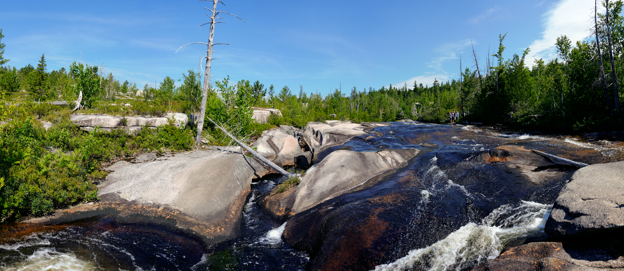
Blueberry Ledges, a side trail we took to enjoy our final day before summiting Katahdin. | Mile 2,180.1 ME 7/31/17
Myself, Chopstix, Olde English and Two step taking a soothing soak in a Katahdin spring fed river. | Mile 2,180.1 ME 7/31/17
Blueberry Ledges. | Mile 2,180.1 ME 7/31/17
Even more Maine pristine forest. | Mile 2,184.0 ME 7/31/17
Halfway up Katahdin, my view of Owl Mountain. | Mile 2,187.8 ME 8/1/17
I completed my thru hike around 8:10 am on August 1st, 151 days after setting out from Amicalola Falls 2,190.3 miles south. | Mile 2,190.3 ME 8/1/17
The view down the back side of Katahdin. Being on this mountain, I felt as if I were truly somwhere special. This place has been important to people for thousands of years and it's easy to see why. | Mile 2,190.3 ME 8/1/17
My gear and a happy Couscous enjoy the moment. | Mile 2,190.3 ME 8/1/17
The Gateway and Tableland, a flat part of the summit that one must cross before reaching Baxter Peak, the highest point on the mountain and the terminus of the AT. | Mile 2,190.3 ME 8/1/17
Two Step, myself, Olde English and Chopstix at the finish line. We shared a lot of special moments and spaces over the course of the hike, and it felt as if being together at the end was meant to be. | Mile 2,190.3 ME 8/1/17
info
/
1
2
3
4
5
6
7
8
9
10
11
12
13
14
15
16
17
18
19
20
21
22
23
24
25
26
27
28
29
30
31
32
33
34
35
36
37
38
39
40
41
42
43
44
45
46
47
48
49
50
51
52
53
54
55
56
57
58
59
60
61
62
63
64
65
66
67
68
69
70
71
72
73
74
75
76
77
78
79
80
81
82
83
84
85
86
87
88
89
90
91
92
93
94
95
96
97
98
99
100
101
102
103
104
105
106
107
108
109
110
111
112
113
114
115
116
117
118
119
120
121
122
123
124
125
126
127
128
129
130
131
132
133
134
135
136
137
138
139
140
141
142
143
144
145
146
147
148
149
150
151
152
153
154
155
156
157
158
159
160
161
162
163
164
165
166
167
168
169
170
171
172
173
174
175
176
177
178
179
180
181
182
183
184
185
186
187
188
189
190
191
192
193
194
195
196
197
198
199
200
201
202
203
204
205
206
207
208
209
210
211
212
213
214
215
216
217
218
219
220
221
222
223
224
225
226
227
228
229
230
231
232
233
234
235
236
237
238
239
240
241
242
243
244
·
·
·
·
·
·
·
·
·
·
·
·
·
·
·
·
·
·
·
·
·
·
·
·
·
·
·
·
·
·
·
·
·
·
·
·
·
·
·
·
·
·
·
·
·
·
·
·
·
·
·
·
·
·
·
·
·
·
·
·
·
·
·
·
·
·
·
·
·
·
·
·
·
·
·
·
·
·
·
·
·
·
·
·
·
·
·
·
·
·
·
·
·
·
·
·
·
·
·
·
·
·
·
·
·
·
·
·
·
·
·
·
·
·
·
·
·
·
·
·
·
·
·
·
·
·
·
·
·
·
·
·
·
·
·
·
·
·
·
·
·
·
·
·
·
·
·
·
·
·
·
·
·
·
·
·
·
·
·
·
·
·
·
·
·
·
·
·
·
·
·
·
·
·
·
·
·
·
·
·
·
·
·
·
·
·
·
·
·
·
·
·
·
·
·
·
·
·
·
·
·
·
·
·
·
·
·
·
·
·
·
·
·
·
·
·
·
·
·
·
·
·
·
·
·
·
·
·
·
·
·
·
·
·
·
·
·
·
·
·
·
·
·
·